

Tuesday, November 17, 2026
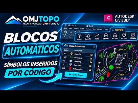
Manually placing topographic blocks and symbols in large survey projects can be a tedious, time-consuming process prone to user error. Whether you are dealing with hundreds of utility poles, trees, manholes, or boundary markers, placing each block individually consumes valuable drafting hours that could be spent on design work. Fortunately, modern workflows allow you to automate this task entirely by inserting topographic symbols based on point description codes.
Streamlining Survey Data with Description Codes
During field data collection, surveyors assign unique codes to points (for example, "TREE" for trees or "POLE" for utility poles). Instead of manually matching these codes to CAD blocks after importing your survey file, an automated tool reads the description codes instantly. By linking these feature codes directly to your customized block library, your raw survey data converts into a complete, detailed map effortlessly.
Why Automate Block Insertion in Civil 3D?
Integrating an automated block insertion tool, such as the solution offered by OMJTOPO, into Civil 3D provides several key advantages for surveying and engineering teams:
- Instant Matching: The tool scans imported point databases and automatically matches each code to its corresponding 2D or 3D block symbol.
- Standardized Layering and Scaling: Every symbol is placed on its assigned layer, correct rotation, and scale, ensuring strict adherence to drafting standards.
- Elimination of Manual Errors: Automated workflows prevent missed points or incorrect symbol placements, boosting overall drawing accuracy.
- Drastic Time Reduction: Complex drafting tasks that once took hours are completed in seconds, accelerating project delivery times.
Maximize Your Productivity
Adopting automated symbol insertion inside Civil 3D completely transforms how land surveyors and CAD technicians handle field-to-finish workflows. By eliminating repetitive manual drafting, you can focus on quality control and technical analysis while maintaining maximum productivity. Upgrade your routine today to experience a smarter, faster approach to topographic mapping.


